Maps and Surveys
Peter Kalm

The most noteworthy artwork included in surveys and reports of the Adirondacks was published by Peter Kalm, a Swedish botanist, and Englishman Richard William Seale. Peter Kalm was the student of famed botanist Carl Linnaeus, the father of modern day taxology, and in 1748, Linneaus sent Kalm on an expedition to North America to collect and illustrate plant samples (Thill 2013). Kalm returned to Sweden in 1751 with over 400 American plants, all of which Linneaus classified and listed (Hall 2011). In dedication of Kalm's efforts, Linneaus named the American mountain laurelafter Kalm, calling it "Kalmia latafloria" (right) (Hall 2011). Similarly, Linneaus named the sheep laurel, which is found in the Adirondacks, "Kalmia augusifloria" after Kalm (Thill 2013).
While Kalm made impotant contributions to the plant classification in general, he also made important scientific and artisitic contributions to the Adirondack region. Kalm traveled to Lake Champlain in 1749 and during his visit, he recorded detailed drawings and observations of the region's plant life in his journal. He included many of these drawings in his publication Travels in North America (1970), a natural study of the Champlain region and one of the first natural studies of the Adirondack region (Mandel 14). In that same year, Kalm made his way to Lake George where he noted the wildlife and vegetation (Hall 2011). Kalm's descriptions and drawings of lichen, pines, firs, and birches in the woods along with chesnut trees on the shores of Lake George have served as a baseline for many later studies of Lake George's plant life (Hall 2011). Evidently, Kalms drawings of plant life in the Adirondacks were scientific in nature as they sought to explain the new terrain, but they also accounted for some of the earliest art in the Adirondack region.
Richard William Seale
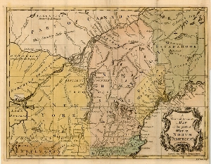
Seale’s work, in comparison, was less scientific and more applicable to the military goals of the English Settlers at the time. His depiction of the Hudson-Champlain corridor in A New and Accurate Map of the present War in North America (1757) (below) illustrates a region of great military importance during the French and Indian War (Mandel 14). Seale constructed many maps of North America throughout the 18th century, as the region of the world was still relatively unfamiliar. Seale's efforts in the Hudson-Champlain region were therefore intended to foster understanding of the foreign landscape. Although Seale's work was more militarily driven and Kalm's drawings and descriptions were intended to advance science, both formulated artwork, in the widest sense, that resulted from views of the Adirondacks as largely unknown terrain and therefore were aimed at helping settlers understand and conquer the newfound territory.
Works Cited
Hall, A. F. "Peter Kalm's Travels in the Adirondacks." Lake George Magazine. 2011. Web. Accessed May, 7 2015. http://www.lakegeorgemirrormagazine.com/2011/06/15/peter-kalm’s-travels-in-the-adirondacks/
Mandel, P. C. Fair Wilderness: American Paintings in the Collection of The Adirondack Museum (A. W. Gilborn, Ed.). New York: The Adirondack Museum, 1990. Print.
Till, M. "Peter Kalm's 1749 Adirondack Journey." Adirondack Life. 2013. Web. Accessed May, 7 2015. http://www.adirondacklifemag.com/blogs/2013/02/13/peter-kalms-1748-adirondack-journey/
Image Sources (in order of appearance)
Banner image courtesy of: http://galleryhip.com/adirondack-on-map.html
Kalmia latifolia courtesy of: http://www.lakegeorgemirrormagazine.com/2011/06/15/peter-kalm’s-travels-in-the-adirondacks/
Seale's Map courtesy of: http://maps.bpl.org/id/14134

