The people traveling through and living in the Adirondacks have always been tied to the park’s waterways. Before the Blue Line marked a land on the New York State map that would be left “forever wild” in 1892, the Adirondack Park was home to Native American tribes who trapped and foraged in the wilderness. Until the time of the American Revolutionary War, the Five Nations of Iroquois controlled the land now recognized as the Adirondack State Park (Indian Country). Since many lakes are not directly connected, or are but only by steep and treacherous streams, the Native Americans carried canoes made of bark between many of these lakes (see sections on Boating Culture and Design).

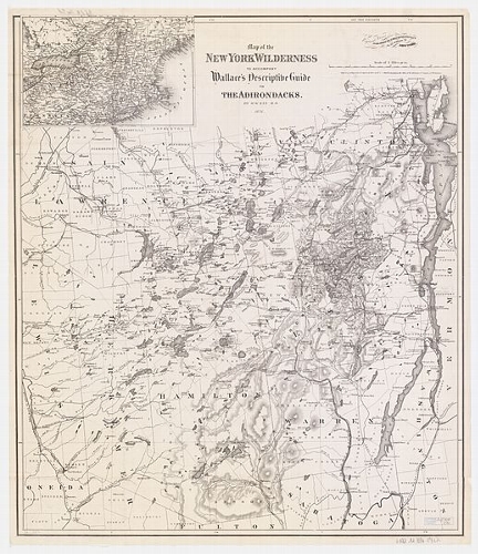
Adirondack Map from 1876 (W. W. Ely / Wikimedia)
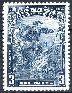
Native Americans set the precedent for transportation in the park long before European colonization. Most who attempted to access the interior of the park did so with boats that were too big to navigate the narrow streams of the Adirondacks. In October of 1525, Jacque Cartier became the first European to see the Adirondacks. The longboats in which he traveled, under the guidance of the Huron tribesmen, were too long and wide to journey upstream on the St. Lawrence River’s tributaries. Cartier’s boats were made to carry large quantities of men and gear, and were therefore much longer and wider than the canoes the Native Americans had been using to traverse the Adirondack waters for centuries. With the help of his Huron guides, Cartier transferred all of his gear and men into Native American-made canoes. Though they still could not travel far into the park, the smaller boats made the passage much easier, and the land slightly more accessible (Bond).
 Even though people did not settle the Adirondack Park until many centuries after Cartier explored its streams, the local Native Americans’ knowledge and experience of transportation in the park was paramount to its colonization. Since the Lake Champlain region was the most agriculturally fertile area in the park, it was the first region to be settled. The next colonized area of land was the region of lakes and rivers between the Fulton Chain and the Saranac Lakes. This region was easily accessible by flat water, and was crucial to how settlers developed and transported goods to the interior of the park. For many early settlers, bark canoes similar to those of the Native Americans in order to move goods from village to village, hunt, and travel to work (Bond).
Canada Post Office / Wikimedia
_______________________________________________________________________________________________________
Work Cited:
1. Bond, Hallie E. Boats and Boating in the Adirondacks. Syracuse, NY: Adirondack Museum, 1995. N. pag. Print.
2. The League of the Iroquois." Indian Country. Milwaukee Public Museum, n.d. Web. 28 Apr. 2015.
Photos:
1. (W. W. Ely / Wikimedia) (http://commons.wikimedia.org/wiki/File:1876_Wallace_Guide_Map_of_NY_Wilderness.JPG)
2. (Canada Post Office / Wikimedia) (http://commons.wikimedia.org/wiki/File:Jacques_Cartier_1934_issue-3c.jpg)

